
TRAIL INFORMATION
The 12 O’Clock Hills are designed for anyone who wants to go walking or hiking in East Clare. Our walks are perfect for everyone, from solo walkers, to groups of friends and family! If you love walking and have a passion for getting outdoors the 12 O’Clock Hills is the perfect place for you to plan your next outing.
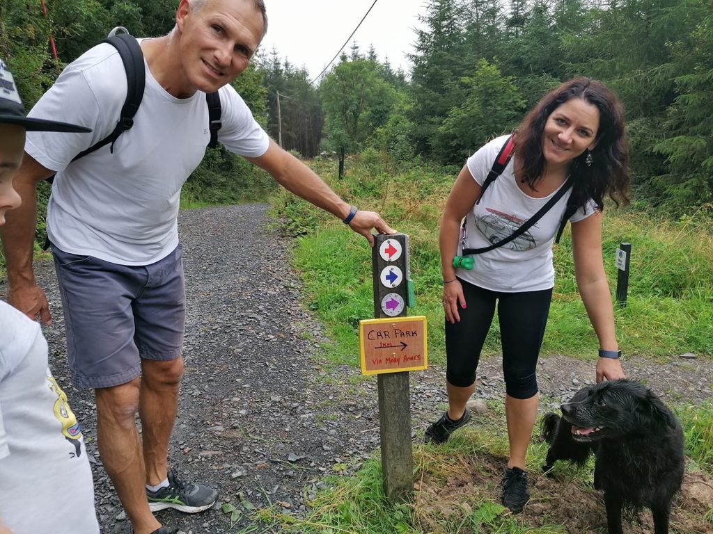
They are marked with coloured arrowheads on way markers or steel plates. All trails take in the Crag River walk, which is approx. 0.6km from the car park.
The RED TRAIL includes a Spur to Fairyland and Stepping Stones recreational area.
The BLUE TRAIL takes in the 12 O’Clock hills and via Sunyata Buddhist Centre and Fairyland on its return journey to the car park.
The PURPLE TRAIL has an added hill named Loughavarra and the 12 O’Clock hills.
All 3 hiking options have recreational furniture for rest periods. The upper hills have panoramic views across the Munster region and have display maps identifying the distant views possible from these points.
TRAILHEAD: Belvoir, Kilkishen, East Clare, Eircode: V95 YKN5. Here there is ample car parking and two public toilets.
Minimum Gear: Sturdy walking boots, rain gear, rucksack, fluids, snacks/lunch, mobile phone.
RED TRAIL
A 5km heritage walk which is mostly flat except for an incline along the Crag River. This linear walk takes in Heritage sites and a Mental Health trail leading to a Fairyland facility for families.
RED TRAIL / Bealach Dearg…via Crag river and heritage sites
Distance: 4 km or 3.5 miles approx.
Total ascent: 160 meters or 525 feet
Level of difficulty: Easy to Moderate
Time: 1 to 2 hours, depending on fitness level
Terrain: Coillte roads, hard-cored pathways and some muddy spots during wet weather, especially on the Crag River trail section
BLUE TRAIL
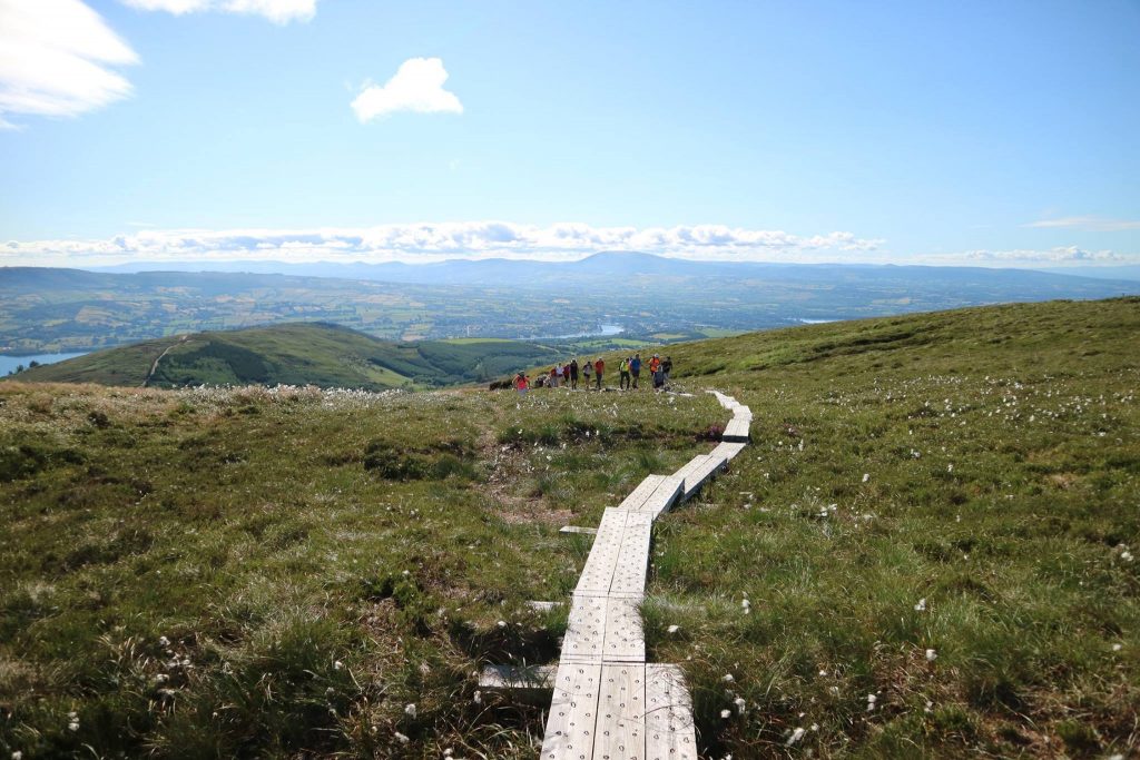
An 8.5km fairly strenuous looped walk up and over the 12 O’Clock Hills at 309m elevation. The upper 12 O’Clock Hill has a compass/sundial to remind people of how people measured time before clocks were invented.
BLUE TRAIL / Bealach Gorm… via Crag river and 12 O’Clock Peaks
Distance: 8 km or 5 miles approx.
Total ascent: 304 meters or 997 feet
Level of difficulty: Moderate to Difficult
Time: 2 to 3 hours, depending on fitness level
Terrain: Coillte roads, hard-cored trails, a boardwalk that can be slippery and some muddy spots, especially in forest sections.
PURPLE TRAIL
A 13km strenuous looped walk for people with a bit more time to spare. This looped walk takes in an additional hill named Loughavarra at 252m and the 12 O’Clock Hills at 309m.
PURPLE TRAIL / Bealach Corcra… via Crag river, Loughavarra hill and 12 O’Clock Hills
Distance: 13 km or 8 miles approx.
Total ascent: 499 meters or 1,637 feet
Level of difficulty: Difficult (carry a snacks or lunch and water)
Time: 3 to 4 hours, depending on fitness level
Terrain: Public and Coillte roads, hard-cored trails, a boardwalk that can be slippery and some muddy spots, especially in forest sections.
FAIRYLAND / Sióg Talamh
Distance: 4 km or 2.5 miles linear walk (return included)
Level of difficulty: easy and buggy friendly
Time: 1 to 2hrs return, longer with a buggy
Terrain: Hard-cored road and path suitable for a buggy.
Follow the fairy signage from the car park to get there.
12 O’Clock Hills, Belvoir, Sixmilebridge Co. Clare
Copyright © 2021 All Rights Reserved.
Website Design by www.ottmarketing.ie & Adept Digital Solutions