The 12 O’Clock Hills are part of the Slieve Bearnagh Mountain Range in East Clare, Ireland. They are located in a line of hills stretching to the southwest from Broadford. The main peak Knockanuarha is 5k to the southeast of Kilkishen Village. Its height is 309m (1014 feet) and it is marked by an Ordnance Survey Triangulation Pillar and laterally a compass/sundial. Knockanuarha has a twin which is 400 metres to the west-south-west and about 10 metres lower.
It is thought that the name 12 O’Clock Hills comes from the local tradition of telling the time by noting the position of the sun against these peaks.
On a clear day all the high mountains of Munster can be seen as well as mountains in Connemara. Quite often the Shannon Estuary can be observed as well as Ennis town, Kilkishen and many of the villages of East Clare with West Clare and the Burren in the background.
All around there is the natural tapestry of lakes, bog and woodland dotted here and there with the ruins of ancient castles. Many of the places of interest can be identified using the compass/sundial at the top.
In 2011 in tandem with the restoration of the old Protestant Church in Kilkishen the potential of these hills to provide a scenic recreational and fitness facility with a local history dimension was recognised. A committed voluntary committee was formed. Considerable support and help was received from Coillte. The cooperation of local landowners was and is much appreciated. The trails were developed and refurbished. Ruins of houses were found and pathways to them made good. Information boards were provided to celebrate their value as heritage sites remembering the hill farmers who lived here until the 1970s.
In September 2014 the 12 O’Clock Hills looped walks facility was opened.
There are three main trails.
RED TRAIL: A 5 km heritage walk which is mostly flat except for an incline along the Crag river. This linear walk takes in Heritage sites and a Mental Health trail leading to a Fairyland facility for families.
BLUE TRAIL: An 8.5 km fairly strenuous looped walk up and over the 12 O’Clock Hills at 309m elevation. The upper 12 O’Clock Hill has a compass/sundial to remind people of how people measured time before clocks were invented.
PURPLE TRAIL: A 13 km strenuous looped walk for people with a bit more time to spare. This looped walk takes in an additional hill named Loughavarra at 252m and the 12 O’Clock Hills at 309m.
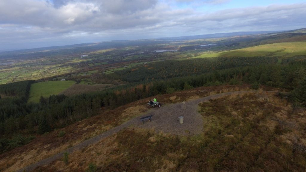
All 3 hiking options have recreational furniture for rest periods. The upper hills have panoramic views across the Munster region and have display maps identifying the distant views possible from these points.
There are information boards at the three trailheads with route maps, difficulty levels, safety information etc. All critical junctions on the routes are signposted.
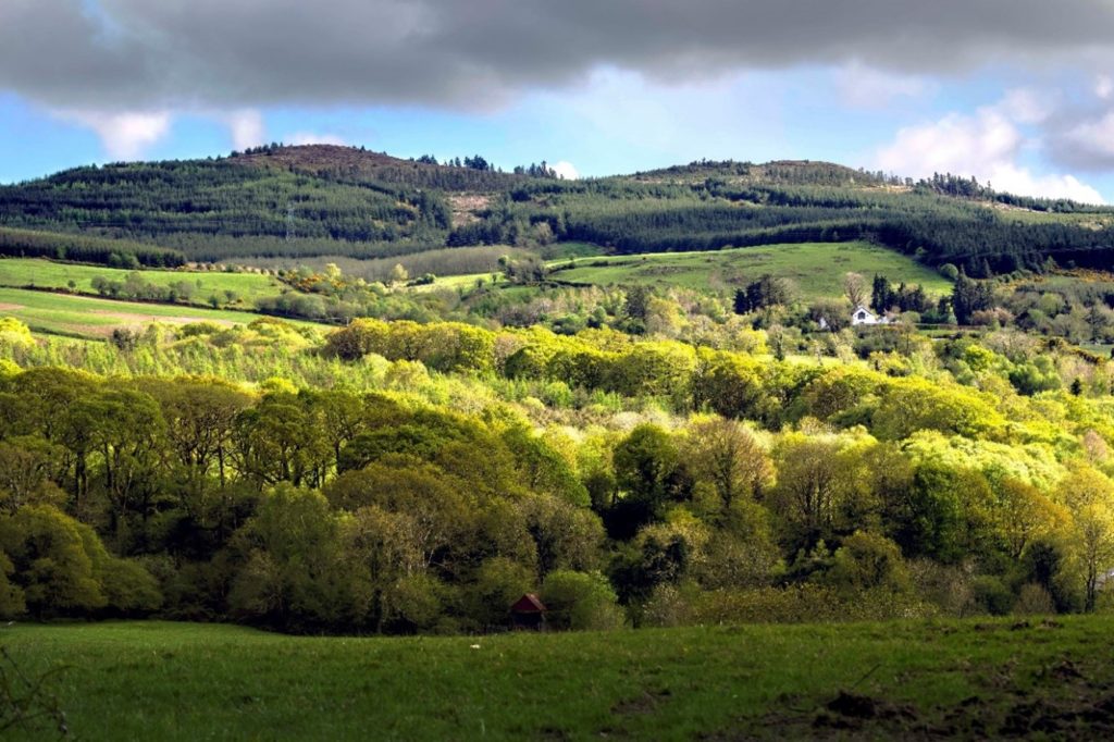
The 12 O’Clock Hills twin peaks as viewed from near Michael Dillons Garage on the L3016 Broadford/Sixmilebridge road
What’s in a Name?
The Twelve O’Clock hills is a local and popular name for a group of hills that lie South East of Kilkishen between the townland of Belvoir and the small settlement of Oatfield. The tallest hill is Knockanuarha at 309m. It is thought that the name derives from a tradition of telling the time by observing the position of the sun in relation to these landmarks.
From these Twelve O’Clock Hills much of County Clare is on view including West Clare, the Burren and the Shannon Estuary while locally Kilkishen village, Cullaun Lake and Steele’s Turret are prominent.
With a little effort, the town of Ennis and many of the villages of East Clare will reveal themselves. Then the attention may be drawn to an attempt to identify the many lakes and bog lands, castles and woodlands. Maybe after a little refreshment and if the day is exceptionally clear, the gaze might lift to the distant horizon; here is an opportunity to pick out the high mountains of every county in Munster.
A RICH HERITAGE
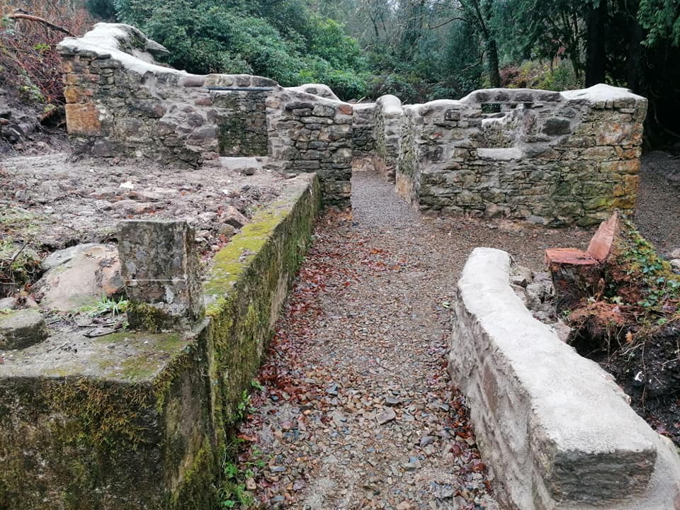
Heritage sites which can be visited along the trails include the restored Crag River Bridge and the partly restored Mary Anne’s stone cottage.
Other heritage sites include the ruins of Dysart Lyons and Brohan’s homesteads, a famine road, Mion Rua bog, the Mass Place and the Stepping Stones.
There is also a Fairyland facility for young families and a Kindness Rocks trail with a mental health theme.
12 O’Clock Hills, Belvoir, Sixmilebridge Co. Clare
Copyright © 2021 All Rights Reserved.
Website Design by www.ottmarketing.ie & Adept Digital Solutions